
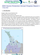
2025 Annual Progress Report: This report provides details of the progress and achievements from 2025 and since the plan became effective in 2016.
2025 Annual Progress Report Newsletter: This newsletter provides highlights of the progress and achievements from 2025.

What is Karst? This infosheet defines karst and provides best management practices for these vulnerable areas.

2024 Annual Progress Report: This report provides details of the progress and achievements from 2024 and since the plan became effective in 2016.

2024 Annual Progress Report Newsletter: This newsletter provides highlights of the progress and achievements from 2024.

5-Year Provincial Source Water Protection Summary: This captures some of the highlights and successes from the last five years of annual reporting on source protection implementation.
2023 Annual Progress Report Newsletter: This newsletter provides highlights of the progress and achievements from 2023.
2023 Annual Progress Report: This report provides details of the progress and achievements from 2023 and since the plan became effective in 2016.
2022 Annual Progress Report: This report provides details of the progress and achievements from 2022 and since the plan became effective in 2016.
5-Year Provincial Source Water Protection Summary This captures some of the highlights and successes from the last five years of annual reporting on source protection implementation.
2022 Annual Report Newsletter: This newsletter highlights local achievements or the protection of municipal drinking water sources.
2021 Annual Progress Report: This report provides details of the progress and achievements from 2021 and since the plan became effective in 2016.

Drinking Water Source Protection Primer: For Municipal Councillors The Safe Drinking Water Act, 2002, includes a statutory standard
of care (section 19) for individuals with oversight responsibilities for municipal drinking water systems, including municipal councillors. This document is a resource for councillors to understand their responsibilities. Updated December 2022.

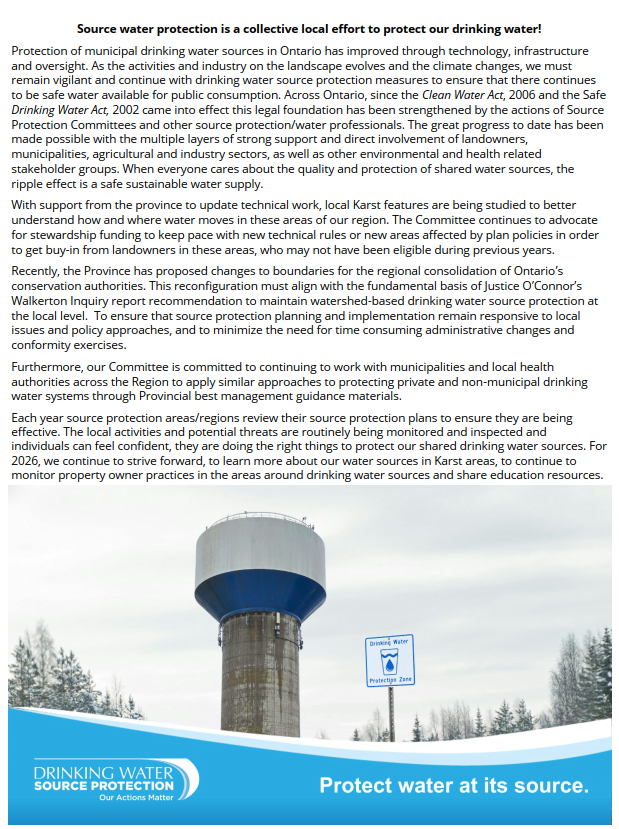
Karst Information Karst is a unique type of land form. It forms as water dissolves soluble bedrock like limestone. Water
alone can dissolve some rock, but some types of rock, such as marble and limestone, need acidic water to dissolve. Updated 2024.
2021 Annual Report Newsletter: This newsletter highlights the achievements made locally for the protection of local municipal drinking water sources.

2020 Annual Progress Report: This report provides details of the progress and achievements from 2020 and since the plan became effective in 2016.
2020 Annual Report Newsletter: This newsletter highlights the achievements made locally for the protection of local municipal drinking water sources.
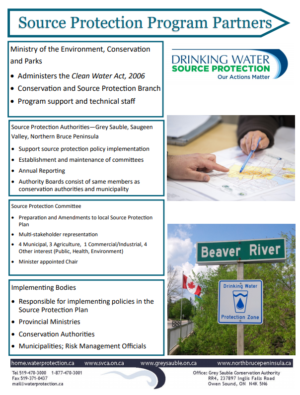
2020/2021 Source Protection Program Partners: This flyer highlights the partners for the source protection program in the Saugeen, Grey Sauble, Northern Bruce Peninsula Source Protection Region.
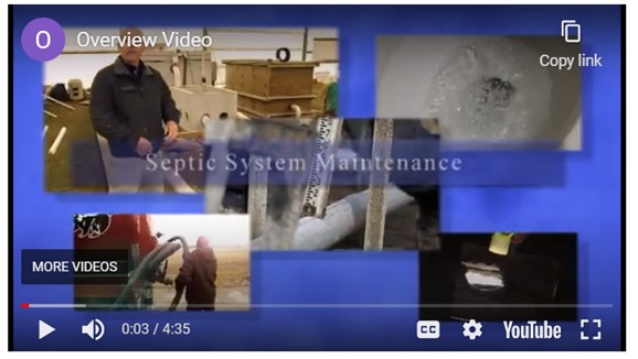
OMAFRA Septic Smart Maintenance Video: This video provides private septic system owners with basic information about design and maintenance of their system.
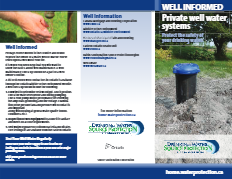
Well Informed Flyer:This flyer provides private well owners with basic information about well design and maintenance and some helpful links.

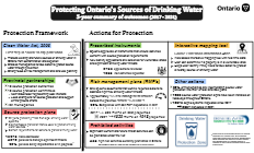
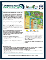
Drinking Water Treatment Plant Operator Factsheet: The Clean Water Act, 2006, is the first step of a multi-barrier approach to protecting drinking water from source to tap. It complements other Ontario legislation including the Safe Drinking Water Act, Ontario Water Resources Act, and the Planning Act. Municipal drinking water systems are an integral part of this approach, providing 85 per cent of Ontarians with clean drinking water. It is important to ensure that the sources of our municipal drinking water are protected now and into the future.
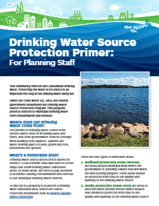
Drinking Water Source Protection Primer: For Planning Staff Development applications, and planning or building permits may be subject to policies under the local source protection plan. An application or permit could be subject to land use planning policies, such as low-impact development for stormwater management, or flagged per restricted land use policies. A flagged application or permit must be reviewed by the local risk management official before it can be submitted to the municipality. In some cases, the proposed activities may require a risk management plan or be prohibited.
Drinking Water Source Protection Program Information This document outlines documents, legislation, policies and relevant zones around municipal drinking water wells that are part of this program.
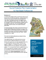
Real Estate Professionals Fact Sheet Many potential home, farm, and business buyers are now aware that certain properties located near our municipal drinking water sources may have some regulated activities. This fact sheet will help to navigate questions from buyers.
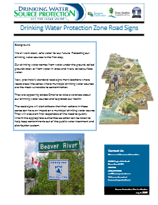
Road Signs for Drinking Water Protection Zones New, provincially standard road signs mark locations where roads cross into zones where municipal drinking water sources are the most vulnerable to contamination. Policy G-07 found in the Source Protection Plan Chapter 6 describes this signage policy.

Risk Management Officials and Inspectors: Regulation of Drinking Water Threats under Clean Water Act Part IV A two page information flyer describing Part IV of Clean Water Act and the roles and responsibilities of Risk Management Officials. Landowner/Renter Rights and Responsibilities and Resource links also included.

Factsheet – General An eight page factsheet explaining Source Protection and the various categories of significant drinking water threats considered by the program. First of five commodity factsheet designed with the agricultural community in mind.

Factsheet – Chemical and Fuel Second of five commodity factsheet designed with the agricultural community in mind.

Factsheet – Horticulture Third of five commodity factsheet designed with the agricultural community in mind.

Factsheet – Livestock Fourth of five commodity factsheet designed with the agricultural community in mind.

Factsheet – Row Crops Fifth of five commodity factsheet designed with the agricultural community in mind.

A three-page document outlining the terms and conditions for using the Saugeen, Grey Sauble, Northern Bruce Peninsula Source Protection Region Vulnerable Areas Mapping Application.

A four-page, tabloid sized newspaper insert on water issues, including a two-page illustration showing the elements of a watershed. Published by Conservation Ontario and several other environmental organizations.

Planning Region Map Map showing two CAs and additional municipality that are in the planning region

Hydrologic cycle Diagram showing components of the water cycle

Source Protection Q and A A two-page pamphlet with general information about source protection planning.
")
Watershed Cross Section (vertical) Graphic representation of a watershed. (0.3 Mb jpeg file)
")
Watershed Cross Section (horizontal) Graphic representation of a watershed. (1.6 Mb jpeg file)
Video Clips from the DVD developed by Conservation Ontario. All video files are in .wmv (Windows Media Player) format.
- Our Limited Water Supply: 1:29 minutes 256 kbps (medium quality) 512 kbps (high quality)
- The Water Cycle: 58 seconds 256 kbps (medium quality) 512 kbps (high quality)
- Our Watersheds: 38 seconds 256 kbps (medium quality) 512 kbps (high quality)
- The Multi-Barrier Approach: 48 seconds 256 kbps (medium quality) 512 kbps (high quality)
- Conservation Authorities In Ontario: 39 seconds 256 kbps (medium quality) 512 kbps (high quality)
- What is a Source Protection Plan? 38 seconds 256 kbps (medium quality) 512 kbps (high quality)
- A Quick Reference Guide to the Clean Water Act
- Clean Water Act Roles and Responsibilities (Brochure)
- Clean Water Act: Source Protection Committee Chair
- Preparing Source Protection Plans
- Source Protection and the Great Lakes
- Technical Bulletin: Addressing Transportation Threats
- Technical Bulletin: Burial of Animals on Farms as a Drinking Water Threat (Deadstock Disposal)
- Technical Bulletin: Climate Change and the Director’s Technical Rules
- Technical Bulletin: Delineation of Intake Protection Zone 3 Using the Event Based Approach (EBA)
- Technical Bulletin: Delineation of Significant Groundwater Recharge Areas
- Technical Bulletin: Delineation of Vulnerable Areas Crossing Jurisdictional Boundaries
- Technical Bulletin: Dense Non-Aqueous Phase Liquids and Organic Solvents
- Technical Bulletin: Earth (Geothermal) Energy Systems as Related to Drinking Water Source Protection
- Technical Bulletin: Groundwater Road Map
- Technical Bulletin: Groundwater Vulnerability
- Technical Bulletin: Part IX Local Area Risk Level
- Technical Bulletin: Proposed Methodology for Calculating Percentage of Managed Lands and Livestock Density for Land Application of Agricultural Source of Material, Non-Agricultural Source of Material and Commercial Fertilizers
- Technical Bulletin: Provincial Tables of Circumstances: Understanding the provincial tables
- Technical Bulletin: Surface Water Road Map
- Technical Bulletin: Threats Assessment and Issues Evaluation
- Technical Bulletin: Water Budget and Water Quantity Risk Assessment, Tier 2 Subwatershed Stress Assessment, Groundwater Drought Scenarios (2010)
- Technical Rules: Assessment Report, Clean Water Act: November 16, 2009
- The Clean Water Act – Clean Water Act Myths and Facts
- The Clean Water Act – Facts